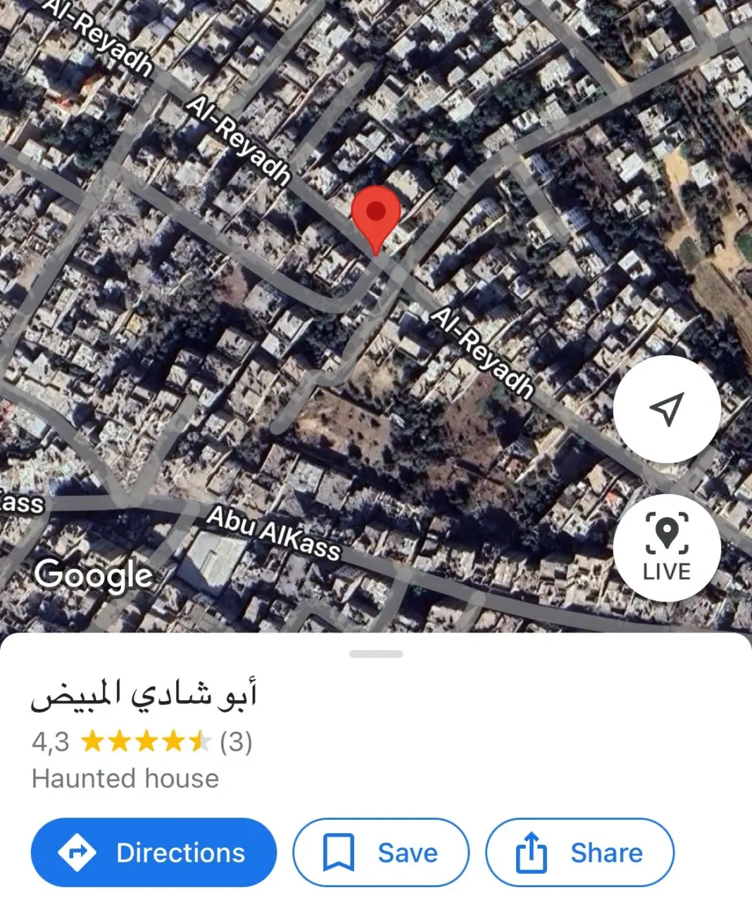

When Google Earth quietly pushed new aerial updates of Gaza earlier this year, researchers and ordinary users zooming into the ruins found something grotesque lurking among the rubble. Scattered across the shattered landscape were dozens of dropped pins marking Palestinian family homes—each tagged with the same chilling category:
“Haunted house.”
The labels appeared on locations bearing Arabic family names: Abu Hajar, A. Hamdi Halabi, Abo Shadi Al Mbyad. Some buildings appeared intact from above even though UNOSAT estimated that 92% of structures in Gaza were destroyed or damaged by early 2025. Others were clearly rubble, reduced to ash and concrete fragments, yet still listed on the world’s most widely used mapping platform as if they were creepy tourist attractions.
To Palestinian-Jordanian researcher Zina Q., who spent months documenting the phenomenon, these weren’t harmless pranks. They were a form of digital vandalism—a deliberate intrusion on the memory and identity of families whose homes no longer exist.
“This is psychological warfare conducted through cartography,” she told one interviewer. “It’s the weaponisation of the map.”
Her investigation, first published in Untold Magazine, uncovered a disturbing pattern: the user profiles behind several “haunted house” labels linked to accounts displaying men in military attire, including one whose location history included Kyiv—suggesting potential foreign military or contractor presence. The evidence is not conclusive, but the symbolism is impossible to ignore: mocking inscriptions left behind on the ruins of Palestinian life.
And as more images of Gaza slowly filter into the public domain, what’s becoming clearer is that the map itself has become a battlefield.
A War the World Wasn’t Allowed to See
For nearly two years, Gaza has been among the least visually documented conflict zones in the world—not because little has happened there, but because Israel systematically worked to ensure the world saw as little as possible.
Israel has:
- barred foreign journalists from entering Gaza since 7 October 2023, except for tightly controlled military tours;
- killed Palestinian journalists at record levels, making Gaza one of the deadliest places in history to report from;
- restricted humanitarian access, limiting independent observation of conditions on the ground.
This censorship created a void that satellite imagery could potentially fill, but even that, Guardian columnist Arwa Mahdawi notes, has been severely delayed.
“If this is what Gaza looked like in late 2024, imagine what it looks like now,” she wrote.
The most recent imagery available on Google Maps—taken in October and November 2024—already shows entire districts flattened:
- neighbourhoods scraped to their foundations,
- hospitals and schools blown open,
- empty grids where apartments once stood.
Even without 2025 imagery, the scale of devastation is unmistakable. The effect is not of a targeted military operation, but a scorched-earth campaign.
Manipulating the Visual Evidence
Israel has long relied on images—its own images—to shape international narratives. But several recent investigations show that these visuals are not always what they appear to be.
Forensic Architecture at the ICJ
During proceedings at the International Court of Justice, Israel’s legal team submitted aerial visuals alleging Hamas activity near civilian infrastructure. Forensic Architecture examined these visuals and identified:
- incorrect labelling,
- misleading annotations,
- and in several cases, completely false claims about what the images depicted.
One supposed “rocket launch site” turned out to be an Israeli airstrike crater.
Sky News debunks Israeli hospital claim
In another case, Israel released footage labelled as targeting a Hamas “command centre” beneath Gaza’s “European Hospital.” Sky News geolocated the footage and found:
- the building was actually a school
- the alleged “command centre” was a drainage ditch
These deceptions matter. They help explain how Western officials—from Washington to London—continue to publicly claim Israel’s actions are “measured,” “targeted,” or “self-defensive” while ignoring overwhelming evidence of systematic destruction.
When the Map Lies
Even when the images are authentic, the way they appear on mapping platforms shapes how the world interprets Gaza’s physical reality.
Delayed updates obscure real-time destruction
The Kyl-Bingaman Amendment—an old US law restricting high-resolution satellite imagery of Israel and Palestine—was partially relaxed in 2020, but practical access to detailed, recent Gaza imagery remains limited. Analysts note that Gaza receives:
- fewer high-resolution passes,
- longer update delays,
- and lower detail levels than other global conflict zones, including Ukraine and Yemen.
The result is a digital twin of Gaza that is historically out of sync, showing buildings intact months after they were bombed.
Hospitals that appear “open” despite being rubble
Google Maps still displays:
- Al Balsam Hospital as “open 24 hours,” despite being surrounded by rubble.
- Al Awda Hospital as functional long after it was besieged, evacuated, and shut down.
- Al-Shifa Hospital—completely destroyed in one of Israel’s most infamous sieges—appearing in some views fully intact.
These distortions are not simply inaccuracies. They become soft tools of erasure, subtly dulling the scale of the humanitarian catastrophe.
“Haunted Houses” and the Dehumanisation of Palestinians
The “haunted house” labels fit into a broader pattern of soldiers photographing themselves looting civilian homes, mocking displaced families, or posing triumphantly on ruins.
In late 2024, Israeli soldiers:
- filmed themselves dancing through destroyed apartment complexes,
- uploaded videos rifling through women’s underwear drawers,
- left graffiti mocking Palestinians on the walls of homes they had occupied.
A spokesperson for B’Tselem described it as:
“Dehumanisation flowing from the top down.”
In this context, calling a bombed family home a “haunted house” becomes an act of digital cruelty—one that echoes the physical violence on the ground.
Safe Zones That Turned Into Kill Zones
Mahdawi noted that Israel’s shifting maps of “safe zones” were themselves a form of manipulation.
In December 2023, Israel marked a tiny strip of south Gaza as a “humanitarian zone.” Families fled there en masse. Many were bombed.
By early 2025, Israel quietly stopped designating safe areas at all.
Satellite images reveal the truth:
nowhere in Gaza was safe.
Then came the drone footage. Israeli media proudly broadcast scenes of Palestinians penned inside metal barricades, starved and skeletal, queuing for “aid” under the watch of Israeli soldiers and American contractors.
Mahdawi wrote:
“This is not aid. It is occupation.”
The Weaponised Map
What emerges from these investigations is a new understanding of modern war.
It is not only fought on land, sea or air, but across digital terrain:
- through mapping algorithms,
- user-generated labels,
- censored satellite feeds,
- and manipulated visuals presented to courts and governments.
Israel’s broader digital infrastructure—from phone surveillance to facial recognition databases to AI-powered targeting tools such as Lavender—completes the picture. Mapping platforms like Google Maps, once seen as neutral, now function as unregulated battlegrounds where truth is contested and power decides what can be seen.
The result is a weaponised cartography that:
- deletes Palestinian neighbourhoods with delayed imagery,
- mocks destroyed homes with vandalised labels,
- misrepresents hospitals and civilian shelters,
- and obscures war crimes behind curated visual narratives.
The Evidence Is in the Images—If the World Will Look
Look at the satellite images of Gaza.
Look at the “haunted house” markers.
Look at the empty grey patches where neighbourhoods once stood.
Look at the obliterated hospitals labelled as “open.”
Look at the manipulated aerial footage.
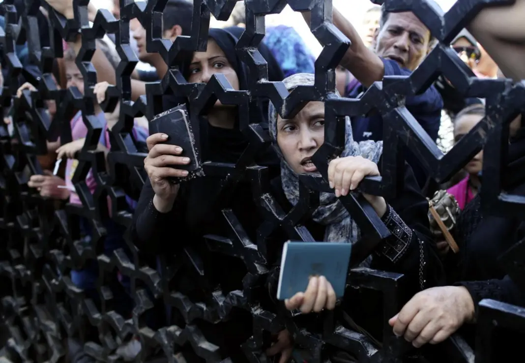
Look at the starving families caged at “aid” checkpoints.
Look at the families who once lived in those tagged houses—now displaced, disappeared, or dead.
If these images—fragmented, delayed, incomplete—are still enough to convey the enormity of Israel’s destruction, imagine what we would see if the world had been allowed an unobstructed view.
Maps do not simply record history.
In Gaza, they are being used to rewrite it.
And this, too, is a crime that must be reckoned with.